Skip to product information

Wall Map
$39.00
Shipping calculated at checkout.
International shipping available!
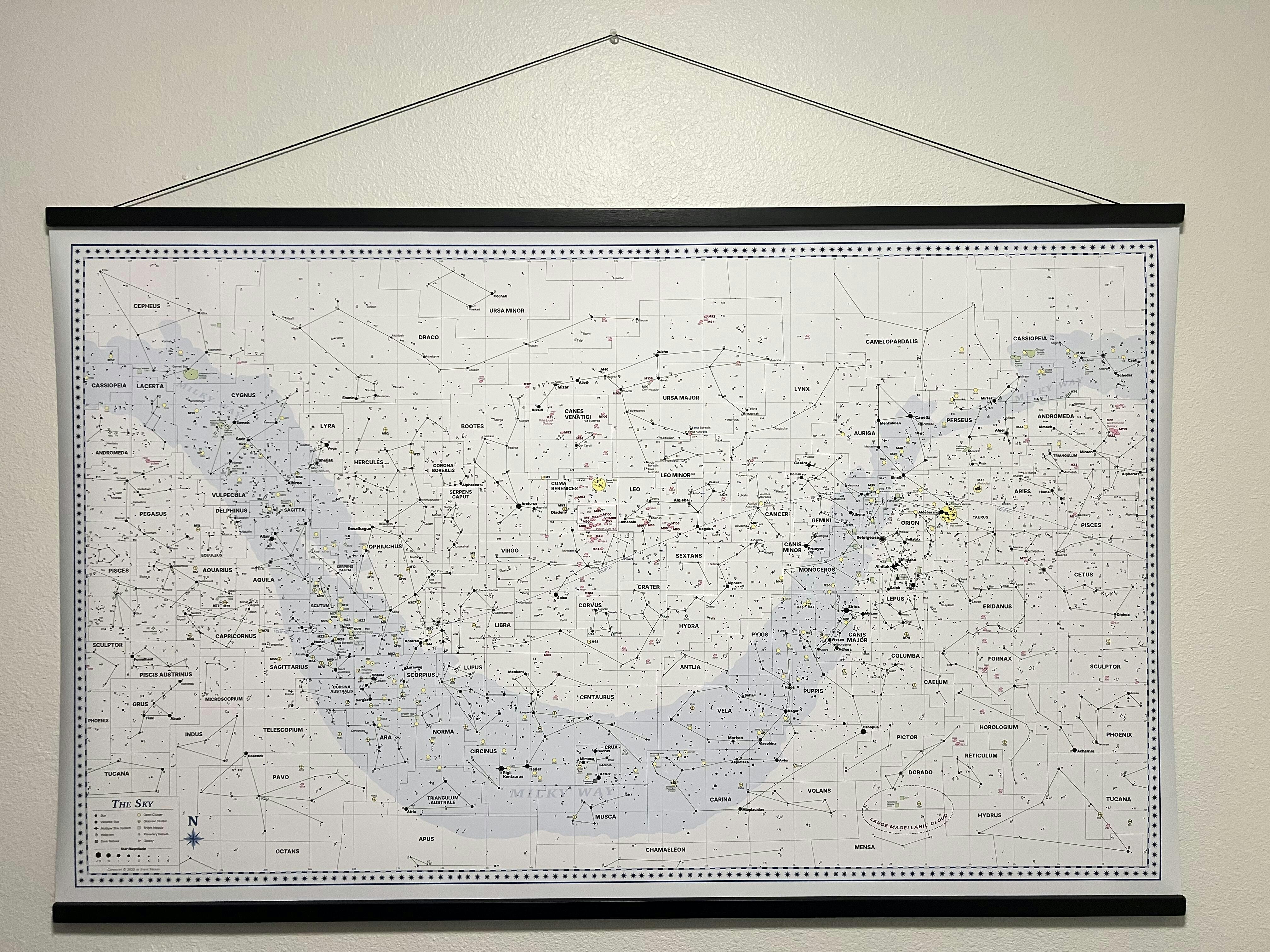
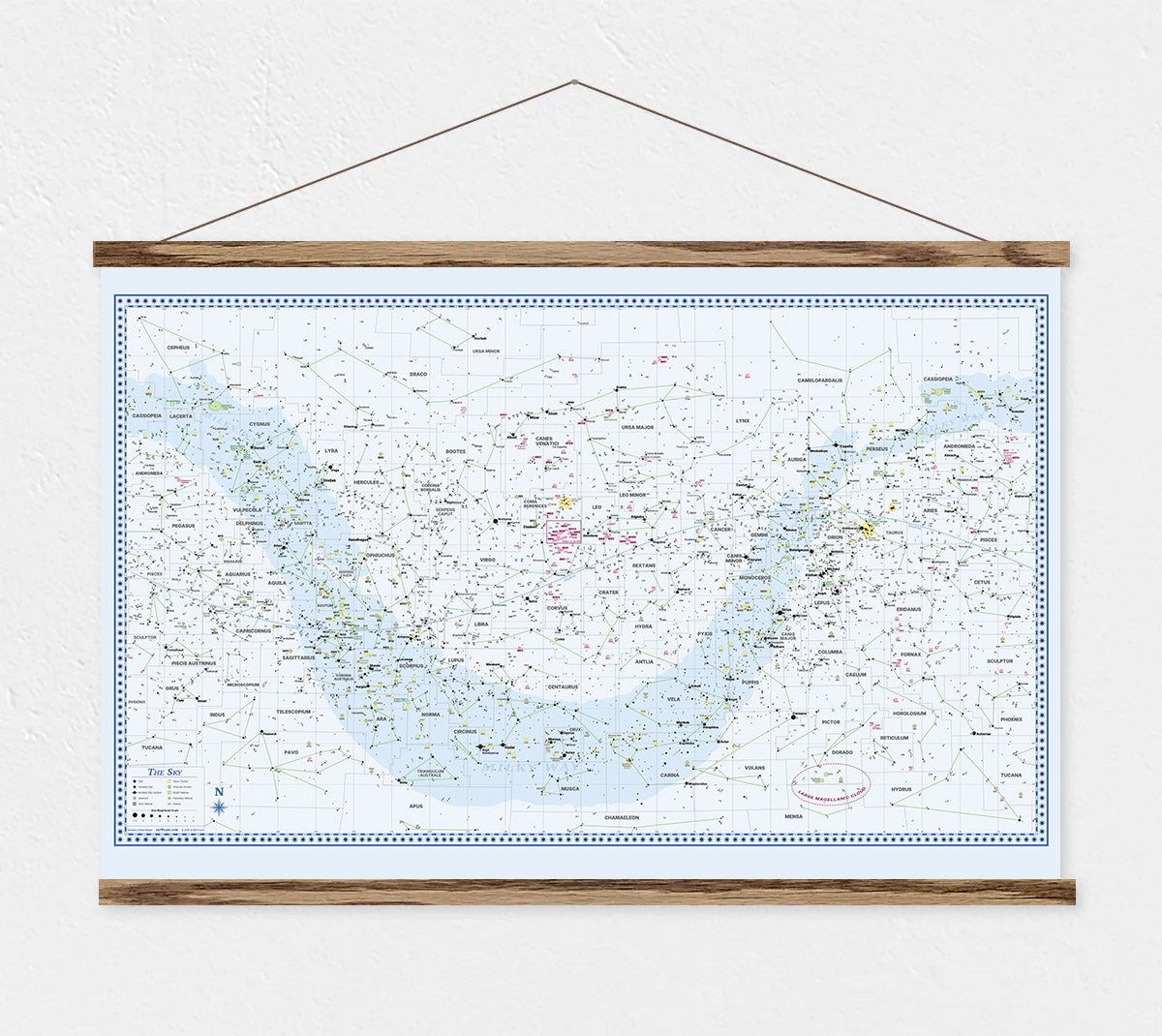
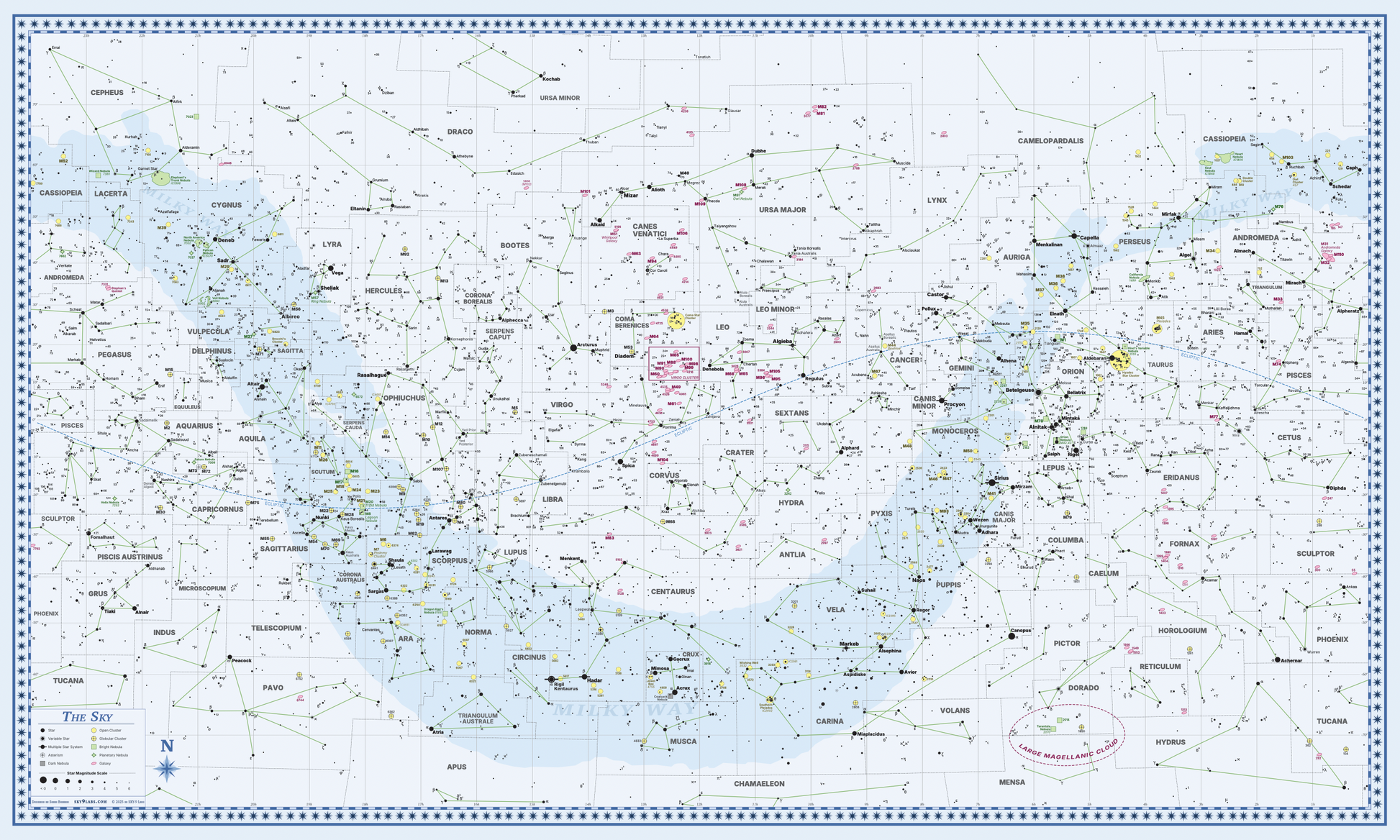
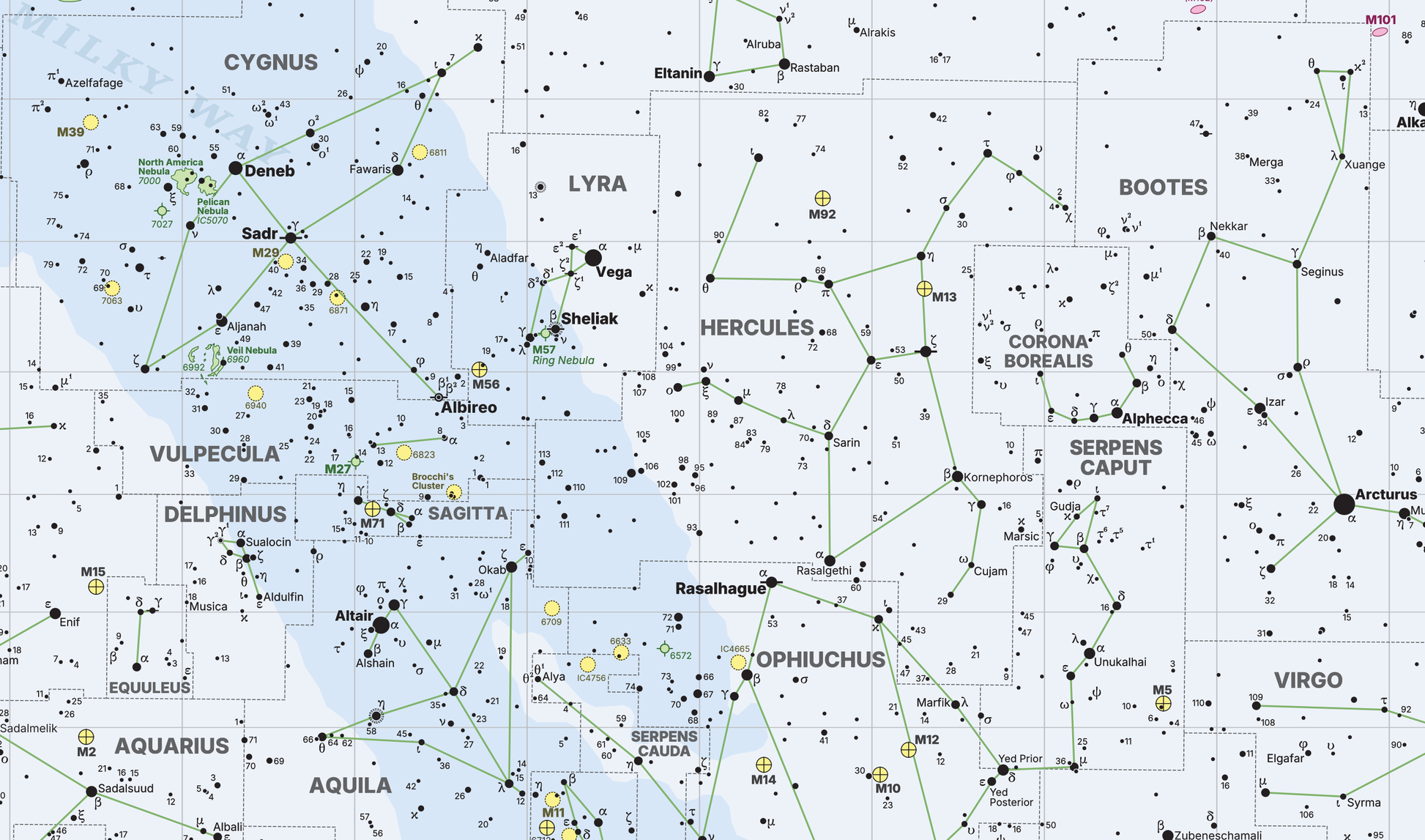
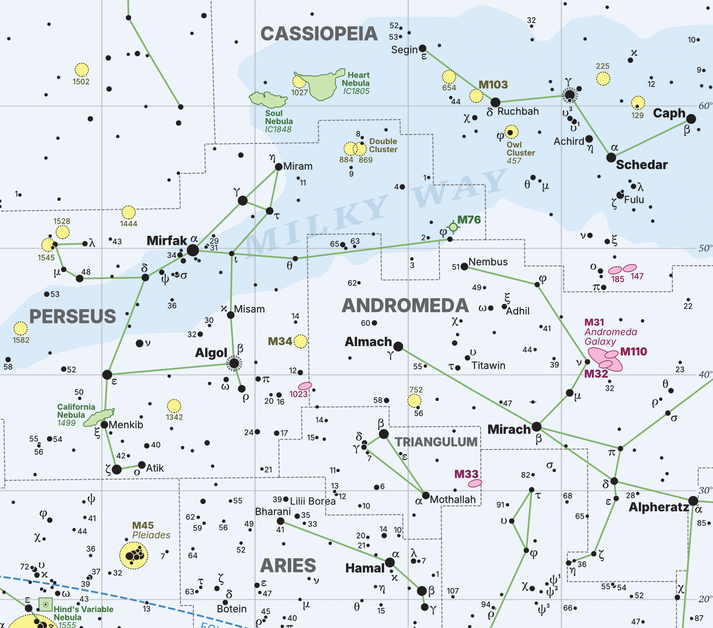
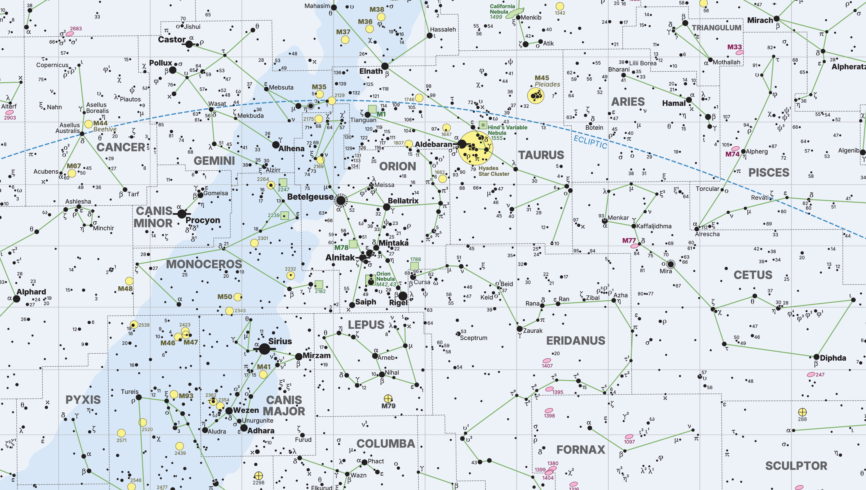
Large format map of the sky! Available in two sizes:
- 36in x 23in
- 48in x 30in
The map shows declinations between -80 and +80 degrees. It's the exact same map from one side of the All Sky Map — just in a larger version more suitable for hanging on the wall.
Printed on 120 gsm polypropylene mylar, which is resistant to moisture. This is different paper than the folded All Sky Map is printed on, so it's NOT waterproof, but it's water resistant and handles changes in humidity very well (so, you can hang it on the wall without a frame).
Includes the print only. The wooden hanger frames are not included (let me know if you'd be interested in these though, I'm considering offering them as an option).

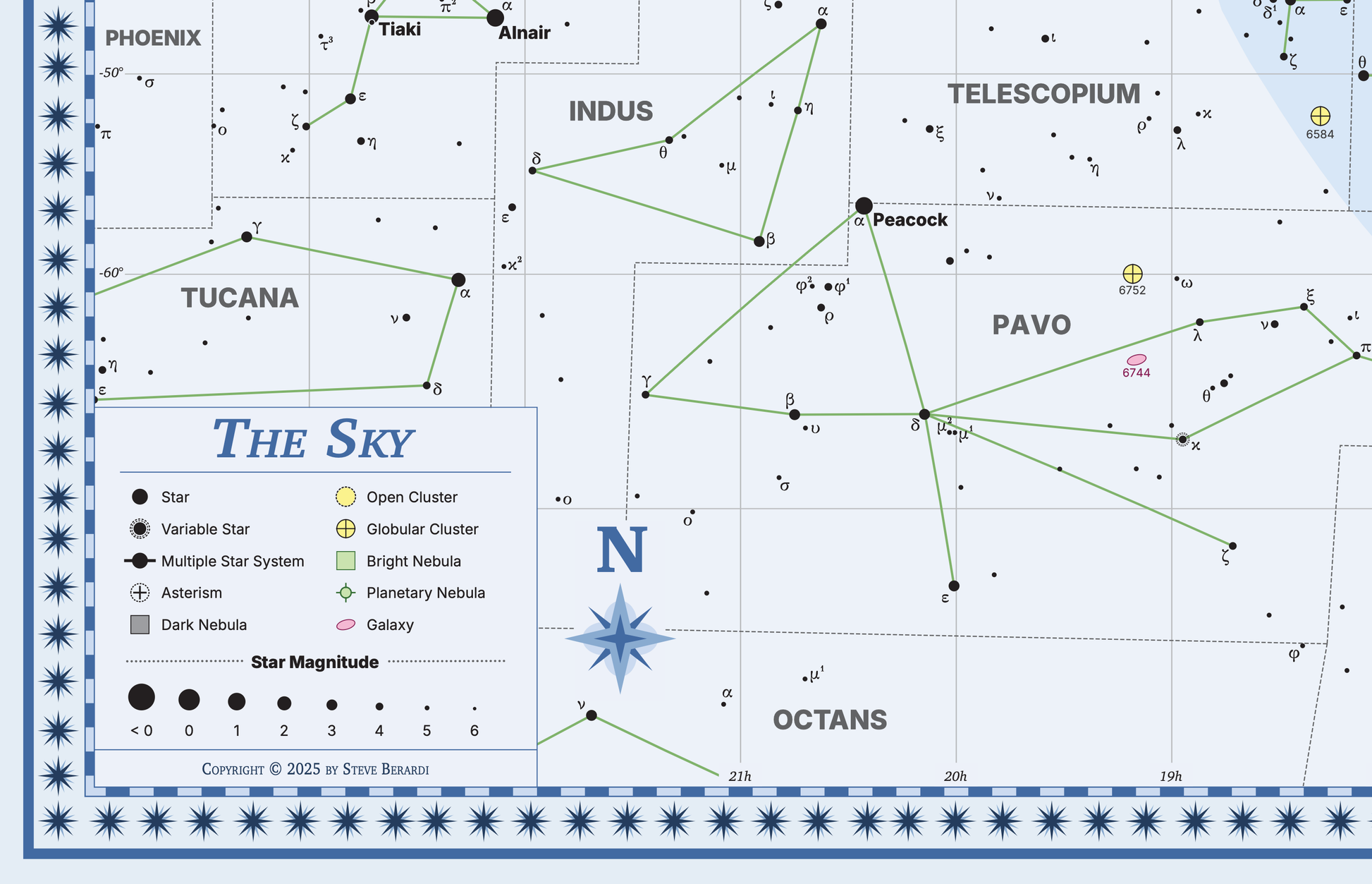
Designed by Steve Berardi
Hello 👋 I'm Steve Berardi — a software engineer and amateur astronomer who loves creating maps of the sky. I create all my maps with Starplot, an open-source Python library I built which is now used by astronomers and astrophysicists around the world. I'm also building Sky Atlas, an app that helps you explore the night sky and plan your observations.
I’ve been fascinated by sky maps ever since buying my first telescope eyepiece from Explore Scientific and seeing those beautiful maps by Wil Tirion on the box. Then I started collecting sky atlases, which eventually inspired me to try and create them.